AI for Pelicans
Detect and classify the pelican population of the Danube Delta in Romania to evaluate the breeding population based on aerial photographs.
Premium participation: Get 1-on-1 Mentoring & Guidance
Try a free mentoring sessionBuild computer vision models to detect and classify the pelican population in Romania as well as automate the evaluation of the breeding population.
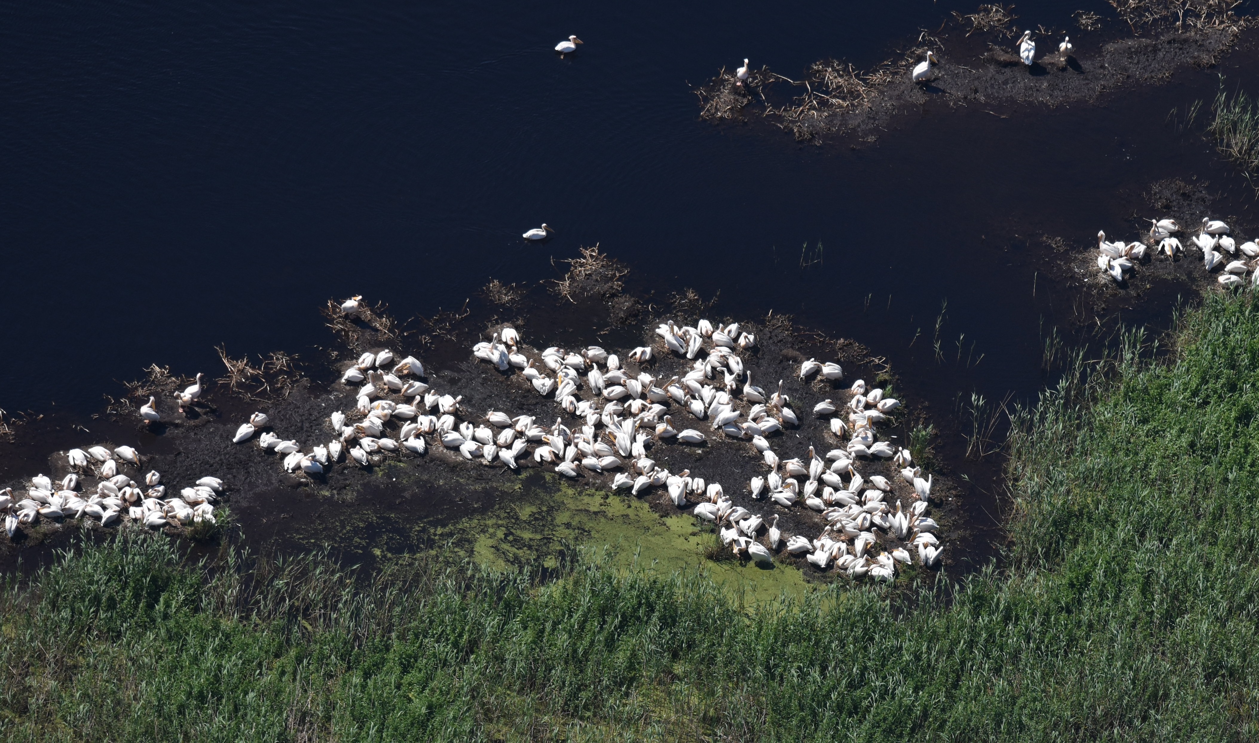
For the last 15 years, the Romanian Ornithological Society has been gathering data in the form of aerial photos of the Pelican breeding population in Romania. Much of it has been evaluated by performing manual counts of the apparently occupied nests. On many occasions, this is a cumbersome process due to the vast number of breeding pairs, running in the tens of thousands. We aim to build computer vision models to tackle this problem. This will allow for constant monitoring and acquiring long-term data to calculate the trend for the species and detect potential changes in their conservation status.
Many breeding waterbird colonies that are located in the Danube Delta are confined to places that are inaccessible by water or land and can be evaluated only during aerial surveys. Most of the pelican breeding colonies are located in the Danube Delta in such inaccessible areas. In order to estimate the total number of breeding pairs in one colony, detailed photographic data, as well as overview images of each colony, is obtained while performing monitoring flights using ultralight aircraft and, recently, drones.
The images obtained are thoroughly analyzed and the apparently occupied nests are manually counted using imaging software (and based on expert opinion) in the following manner: Birds that are considered as certainly sitting on the nest are tagged, while those that are considered only potentially breeding are accounted for separately. The end result sums up the certain breeders as the minimum number of breeding pairs to which the “potentially breeding” is added in order to get the maximum.
In this challenge, we will
- Extract label-pixel coordinates from large aerial imagery
- Estimate Bounding boxes for the pixel coordinates
- Build CNNs
- Train object detection models
- Create a GUI for researchers to check and adjust the predicted labels and pelican count
Technologies we will use
- Clustering
- Object detection
- Classification
- Regression
- MLOps
Who are we looking for?
We are looking for data science & AI engineers, previous work with computer vision would be of great benefit.
You will collaborate with a diverse team of up to 50 international participants in subteams. You can join as a contributor (8-12 hours per week commitment for 10 weeks) or coach (2-4 hours per week, only for experienced ML professionals)
We’ll organize masterclasses on ecology and computer vision during the challenge to bring you up to speed.
Did you know
🦆 “Apparently occupied nests” is a concept used frequently in estimating the number of breeding birds in colonies based on aerial imagery. Experienced observers can detect the number of breeding birds based on their position and nest structure.
🦤 The largest European breeding colony (more than 95% of the European population) of Great-white Pelicans is located in just one colony in the Danube Delta, Romania. Based on estimates and counts during the last 15 years, this colony contains variable (from one year to another) numbers of breeding pairs from several thousand to more than 15000 pairs.
🐓 Counts can be performed, not only of the breeding birds but also on the total number of birds located in the colony (breeding and roosting) in order to have a better general image of the population
Info session

Timeline
Application Deadline: 28 May 2023
Challenge Kick-off: 30 May 2023
Midterm Presentations: 27 June 2023
Final Presentations: 8 August 2023


.png)
